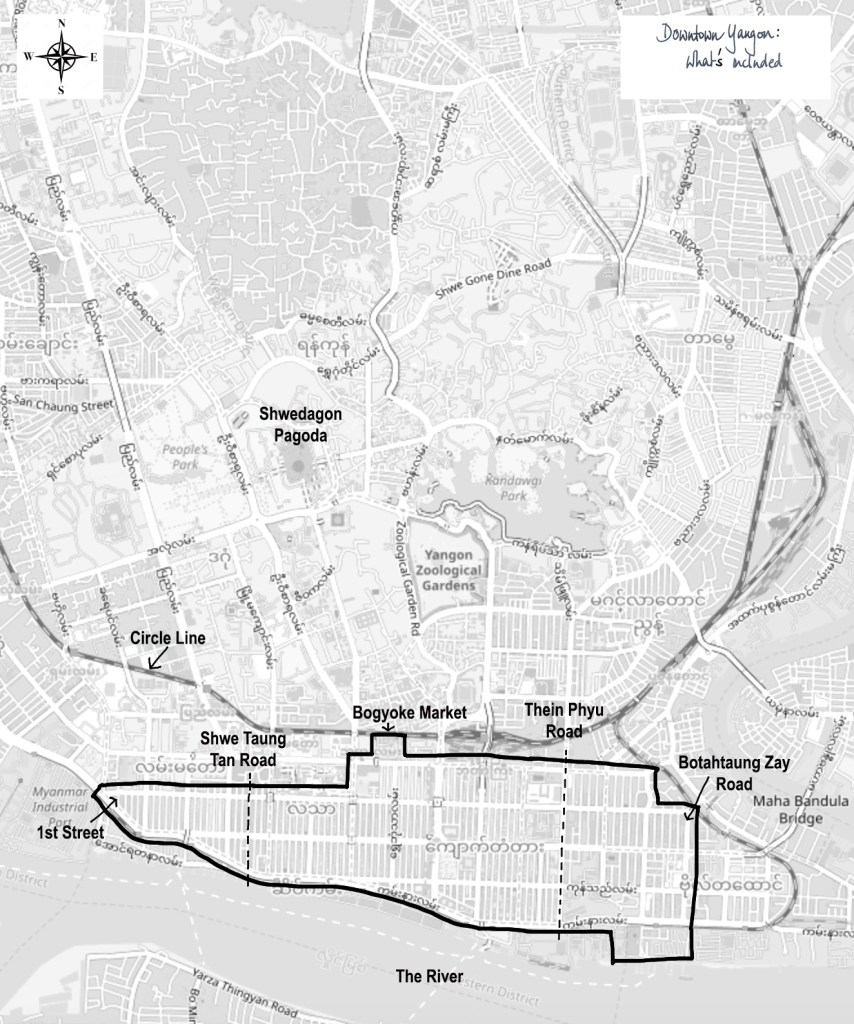
For the purposes of the Yangon Street Map, downtown Yangon is defined as everything between the circle line railway to the North and the river to the South, and from 1st street in the West to Botahtaung Zay Road in the East, as shown in the map.
All the North-South streets between Shwe Taung Tan Road in the West and Thein Phyu Road in the East are individually mapped and listed in order from West to East.
The streets between 1st Street and Shwe Taung Tan Road are covered by one map, entitled “West of Shwe Taung Tan Road: 1st to 14th” .
The streets between Thein Phyu Road and Botahtaung Zay Road are also covered by a single map, entitled “East of Thein Phyu Road: 45th to Botahtaung Zay”.
Thanks to Open Street Map for the underlying map used here:
2019 © OpenStreetMap contributors
